
March 9-March 14

March 9 – Los Antiguos, Argentina to Gobernador Gregores, Argentina

I had to leave the group early so that I could arrive in Gobernador Gregores for a six-hour phone call. I was on the road at 7:00 am, about an hour ahead of the group. The first 60k was due east and I was leaving at sunrise. It was about 45 degrees out and the sun was directly in front of me or just right or left. As a result, I was very cold and working with only 30%-50% visibility…very dangerous conditions. Further, I was entering guanacos territory. Guanacos are camelids, cousins of llamas and vicunas, that stand about five feet tall and are 200-300 pounds.
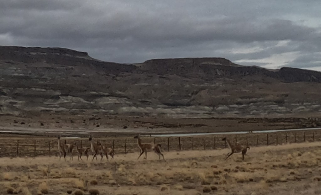
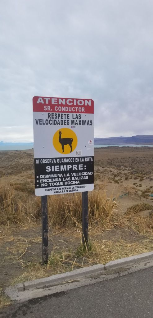
There were hundreds of guanacos along the road and in the surrounding countryside. Guanacos are dumber than a bag of hammers (attribution to Gary)…they have a habit of standing right off the side of the road and then suddenly darting out into the road when one is approaching. As a result, one must be very careful around them because the direction they choose to run could very well be in the path of the motorcycle, which I did see happen several times. To add an additional element of surprise, they are very well camouflaged, so they blend in extremely well with the environment. Suddenly, you can be on top of them and have to react. All of this can be a challenge when going 100k-150k per hour with limited visibility. I had a few close encounters, but nothing too frightening…I made it through my first day of riding in guanaco territory.
The environment I was riding in this day changed very dramatically from yesterday. Today the route took me through the wide-open plains of Argentina, or the pampas. One can see for miles when riding through the relatively flat scrub land…none to very few trees, some rolling hills and a few river valleys, but otherwise flat and wide open with the major colors being beige, brown and sand. It reminds me of the savannas of Africa. Also, it can become very, very windy, as in 50+ mph winds, due to the unique weather and geography of the area. Luckily today, the winds were non-existent to minimal.
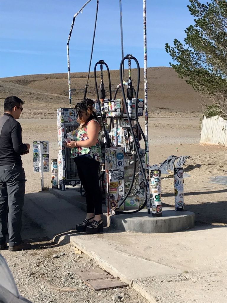
I had to stop for fuel in a very small hamlet of maybe 25 buildings called Bajo Caracoles. Bajo is definitely one of those strange little towns that crop up for some reason and becomes populated by loners, renegades and recluses. It sits literally in the middle of nowhere in an inhospitable environment…wind-blown, isolated and who knows why it is where it is. There is a doctor, lawyer, mechanic shop and a bodega with two gas pumps. It is a key location for motorcyclists because there isn’t fuel for many kilometers in any direction and one can’t make it on this section of Ruta 40 without gas from here or carrying external gas tanks. I have a two-gallon gas bag with me, filled up, but I still stopped to fill up my gas tank just in case. Below is a picture of the gas pumps with all the stickers from motorcyclists around the world that have passed through.

I went into the small bodega to buy gas and there were two women, one in her 20’s and another in her 40’s behind the counter. In my broken espanol, I asked for gas and the older woman turned to look at me, never said a word, just pointed to the door and started walking out. When she came from behind the counter, she was dressed in platform sandals, black stretch pants and a styling top and she had a very snobbish attitude. All I could think of at that moment was how incongruous she was to the surroundings. I kept looking around for an underground nightclub or some other reason she would be plopped down in this crazy, weird little place. Plus, the 20-something behind the counter rolled her eyes at her colleague as she walked out the door and gave me a smile…who knows what weirdness goes on in this place.
Around dinner that evening, we all decided that the above woman was dressed to attract someone’s/anyone’s attention and ask her to leave Bajo Caracales with him. She probably has a bag packed and stored under the counter, so she can walk out at anytime…
Anyways, I filled up and headed out of town, but I noticed a travelers motorcycle that was packed up and seemed ready to go in the small enclosed courtyard of the doctor’s office right near the gas pumps, which struck me as odd.
I headed out south and made it into Gobernador by noon, checked into the Hosteria Lago Cardiel and had a strange lunch with the local crowd. Surprisingly, the hotel had good internet and cell coverage and I was able to make my call. However, the hotel didn’t have much of anything else to offer and was a run down, seedy little place in this backwater town. I felt like I was back in one of the mining towns in northern Chile.
I had a break in my call so I went outside to see if I could grab a snack somewhere nearby and several members of the group, JD, Eric, Kevin and Craig were outside the front of the hotel working on the bike I had seen in Bajo. When the group got to Bajo behind me, somehow JD ran into the owner of the bike, Alexander, a 30-year old from France who has been traveling for two years. Alexander explained his situation to JD. He had bought his bike in Argentina dirt cheap (a Royal Enfield) and had been driving it when it broke down in Bajo. He had been stuck there for two days and staying with the doctor I mentioned above. Alexander didn’t know how he was going to get out of there. Luckily for Alexander, he had just run into probably the greatest concentration of motorcycle knowledge and expertise in Argentina at that moment in time. JD used to participate in enduro races which requires racing for up to six-days straight and requires the rider to fix his own bike, if there are any problems. Eric is a very experienced rider and mechanic and has an extensive network throughout Argentina related to all things motorcycles. Lastly, behind the truck that Eric drives is a trailer with three slots for motorcycles, all of which were empty.
After JD heard Alexander’s story, he convinced Eric to load Alexander’s motorcycle on the trailer and take Alexander with the group to Gobernador, which has a motorcycle repair shop that Eric knows of. So, JD and Eric had Alexander’s bike broken down and diagnosing the problem(s) when I walked out. As it turns out, the bike needed extensive repairs and parts, which would take about 10-days to arrive and be installed. So, JD got Alexander a hotel room (which JD paid for) and bought him dinner and made sure he was situated and ready to deal with his issues. Alexander decided to take the next 10-days and hitch hike to Torres del Paine. JD and Eric got him out of Bajo and on his way. One last detail….when he was in Bajo and staying with the doctor, Alexander said that all the doctor did for the entire time he was there was sit in front of his TV and watch old western movies….more strangeness coming out of Bajo!!!
March 10 – Gobernador Gregores, Argentina to El Calafate, Argentina

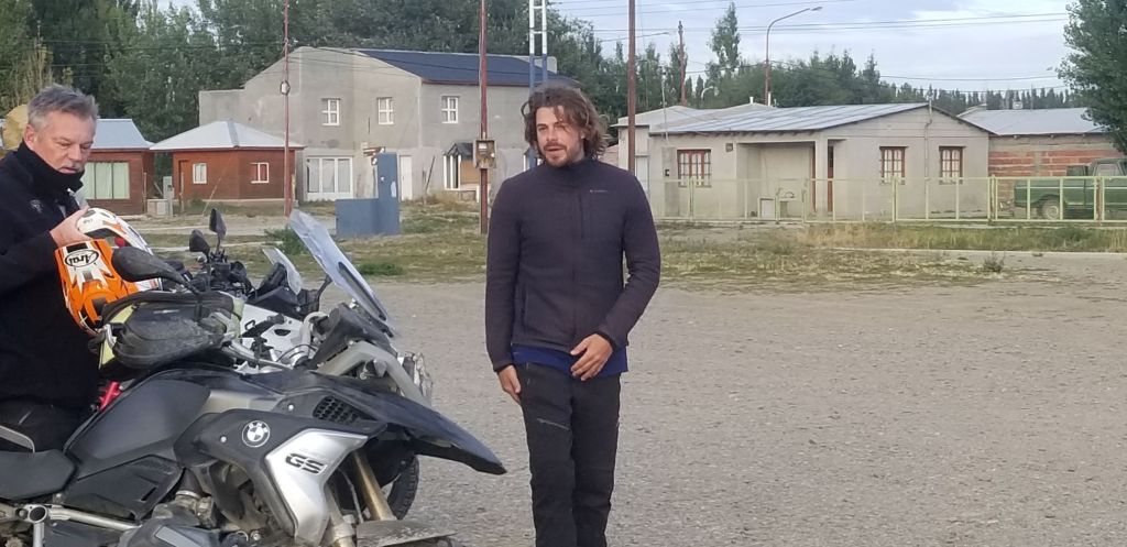
We got going at about 8:00 am after Alexander came out to say thanks and goodbye to everyone.
We had to stop for gas immediately because the station was out of gas the night before and there is only one gas station in the town and for many kilometers around. Unbelievable, that they can’t better manage their supply issues here. There must be some issue related to government control or regulation of the gas supply because it is not well organized.
In the morning as we were getting ready to go, Eric, as he does every day, gave us an overview of the day’s ride. Today’s ride included about 70k of hard packed gravel with marble sized rocks on top and in some places the rocks pile up between the tracks and create a very unstable and dangerous surface (kilometer long piles of marble sized rocks 2 inches to six inches deep) requiring one to ride the track and stay out of the piles. Eric warned us about this section and said to take it easy. What he failed to tell us was that he calls this the Death Zone (we found this out over dinner). Typically, this is where there are serious injuries, if someone is going to get hurt due to the degree of risk in riding this surface. For once, I headed Eric’s advice and took this section at my own pace to ensure I was in control and didn’t encounter a disaster. Even with that, this was a tough ride. When we were having lunch, everyone commented on how hard it was riding through these conditions. I had one scare where I lost control of the bike and started into a series of about three foot arcs back and forth in the deep gravel. Surprisingly, I was able to gain control and keep the bike upright.
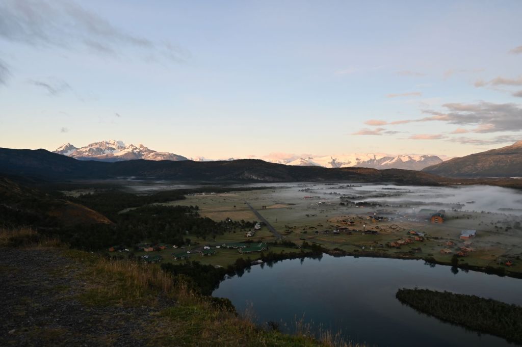
Our goal this day was El Calafayte, which is a tourist town about 60k away from the Perito Moreno Glacier. Further, we will be heading back west towards the Andes and the mountains begin to appear in the distance as we approach. Below is a pic of the Mount Fitzroy massif we could see in the distance.
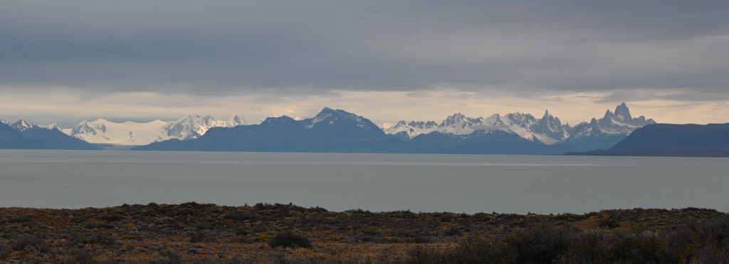
Next time back, I plan on spending time around Fitzroy to camp and climb.
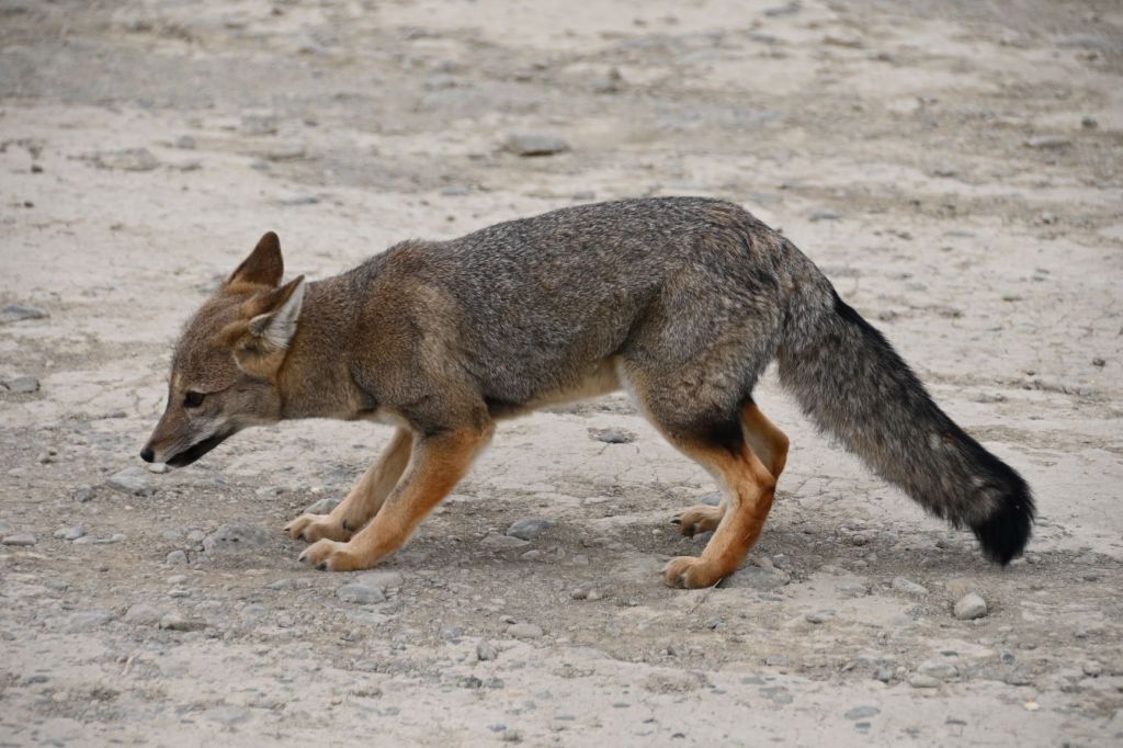
When I stopped to take the above picture, the fox below came creeping onto the miranda and was begging for food from everyone who stopped.
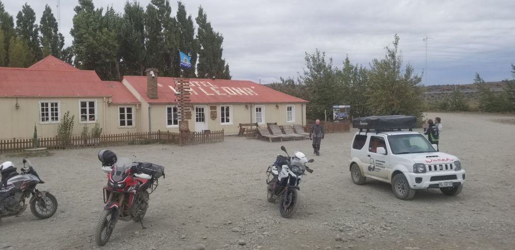
We stopped at a historic place for lunch called La Leona. Butch Cassidy and the Sundance Kid frequented this place when they were on the lam from Pinkerton’s. I didn’t realize until now that they had run this far south. I was informed this day that they were caught and killed in Boliva.
The restaurant is an old building set on a river running out of the glacier runoff from the Fitroy massif and was running very strong and high. Great empanadas for lunch.
Interestingly, at least to me, the car in the picture below is a Suzuki Jimny, which is what we drove from London to Mongolia in 2011. Seeing it brought back great memories of the Mongol Rally and my time with Bobby Carey and Bob Picchietti.

El Calafate was as advertised a tourist town with many backpackers and all the expected tourist shops, craft brewers, chocolate stores and expedition outlets.
March 11 – Rest Day in El Calafate
As luck would have it, rain was in the forecast, so a good day to be off the road. The bad news is we needed to travel about 80k to get to one of the great attractions in South America, the Perito Moreno Glacier. We looked at the weather and it was supposed to break around 10:00 so we took the opportunity to hang out and rest. The weather did start to break and JD, Craig, Mike and I headed out. Great ride west into the Andes.
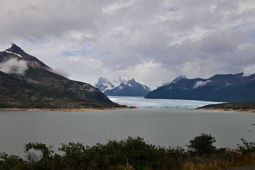
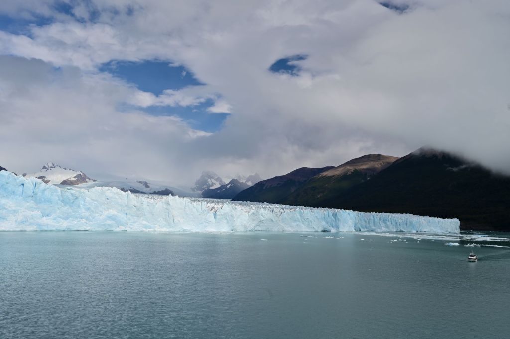
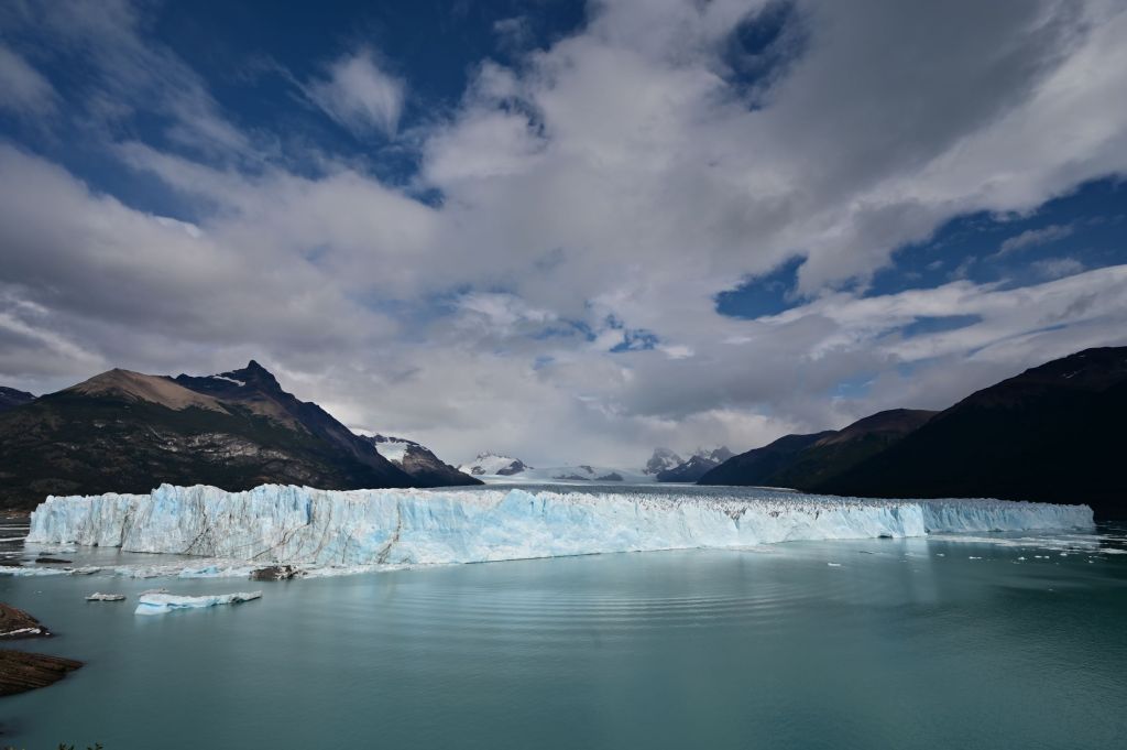
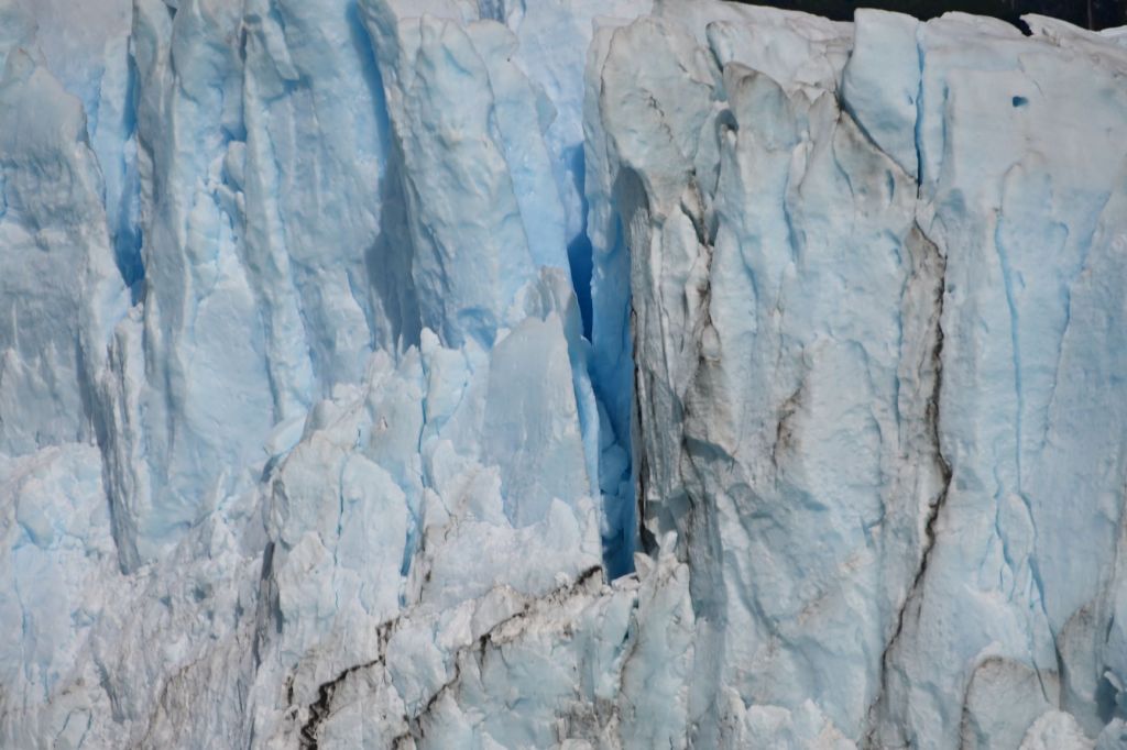
The Perito Moreno Glacier is a spectacular sight with a park surrounding it. The glacier comes within about 400-500 yards of a large hill around which walkways and viewing areas have been built facing the glacier. The glacier advances upward about 70 meters from the water for a a horizontal distance of about one kilometer. When we got there the sun came out and the glacier started calving with all the associated cracking sounds and huge blocks of glacier falling off the wall into the surrounding lake…an awe-inspiring site. We probably spent about an hour just listening and watching this massive display of the forces of nature.
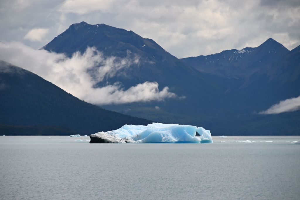
I’ve included the below photo to provide some perspective on the size of the glacier. The ship on the lower right hand corner carries about 100 people and is dwarfed by the glacier.

Below is a great pic of Mike. I made a critical error in my last posting. Mike was in the Marines…not the Army!!!

Had my best dinner on the trip this evening with Eric at La Tableu.
March 12 – El Calafate, Argentina to Torres del Paine, Chile

We left El Calafate at sunrise, which painted the sky and clouds an intense pink and yellow. Today, our ride ends in Torres del Paine Parque Nacional, one of South America’s leading attractions. The ride took us east back into the pampas across the border into Chile.

Hard on the border crossing on the Chilean side, we stopped for lunch. There is a restaurant/gift shop/cambio called El Ovejero run by a real character, whose name I didn’t catch. A picture of the place is below. It is covered in travelers’ stickers from all over the world due to it being a choke point going into the Parque from Argentina.
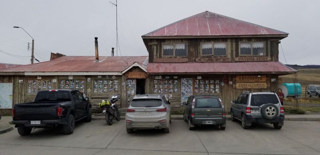
The owner was sitting at the door in a Hawaiian shirt and a Patagonian beret. He had command of the entire place as the cashier, cambio and maître de. Further, the Ford Raptor sitting in front of the place above is his. No one drives this type of vehicle in this area of the world! All the locals and tour guides had to “kiss the ring” of the owner. According to Eric, he also owns the local hotel and an estancia close by…so he pretty much owns everything in the area. It was amusing to watch the whole scene unfold as we had lunch. Again, one of those times I wished my espanol was sufficient to engage in a conversation and learn more about this interesting character.
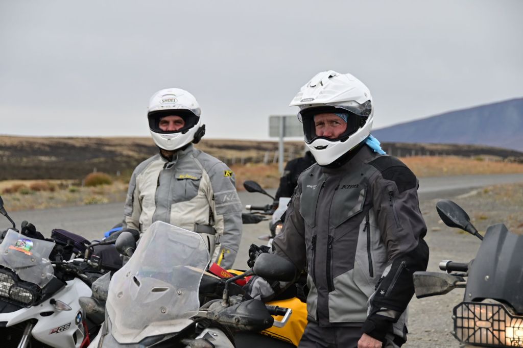
Below is a photo of Craig who was photobombed by Eric.
Torres del Paine is truly spectacular. I would put it the same category as Grand Teton, Yellowstone or Yosemite National Parks. A huge high alpine massif with highly unusual features and world class hiking, camping, fishing and climbing. The difference is that is populated by about 2% of the people one would typically see in the above U.S. based national parks.


We stayed at a nice lodge, Hotel del Paine, hard on the Rio Serrano, which I got a great shot of the next morning, which is below on March 13.
March 13 – Torres del Paine, Chile to Cerro Sombrero, Chile
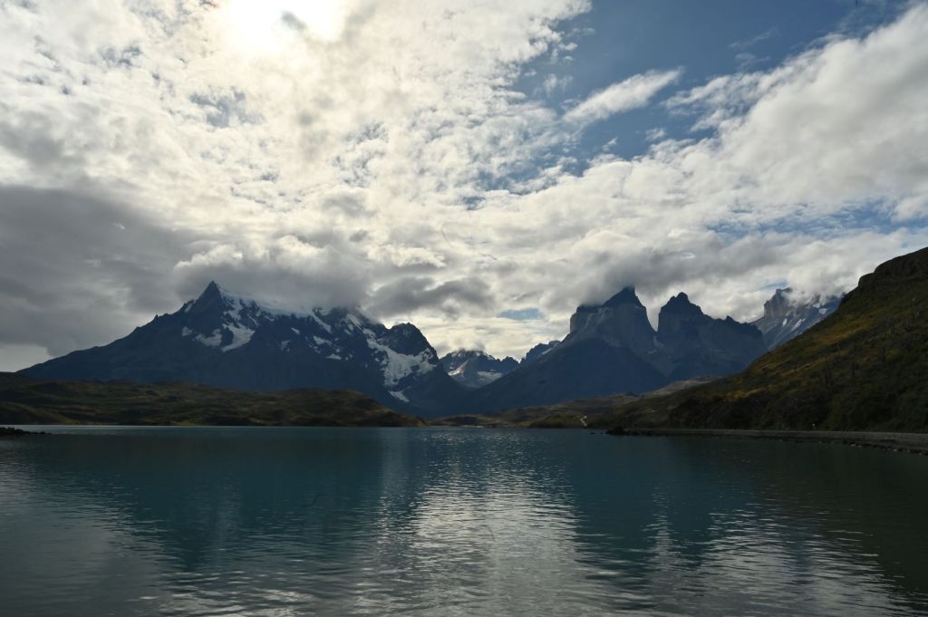
I was able to get up early, before sunrise, and ride to an overlook of the Serrano Valley and the Torres del Paine massif. I was extremely lucky that the sky had cleared and it was a crystal clear morning great for photographs.
Our lodge is the one in the lower mid/left section of the photo below right on the Rio Serrano.


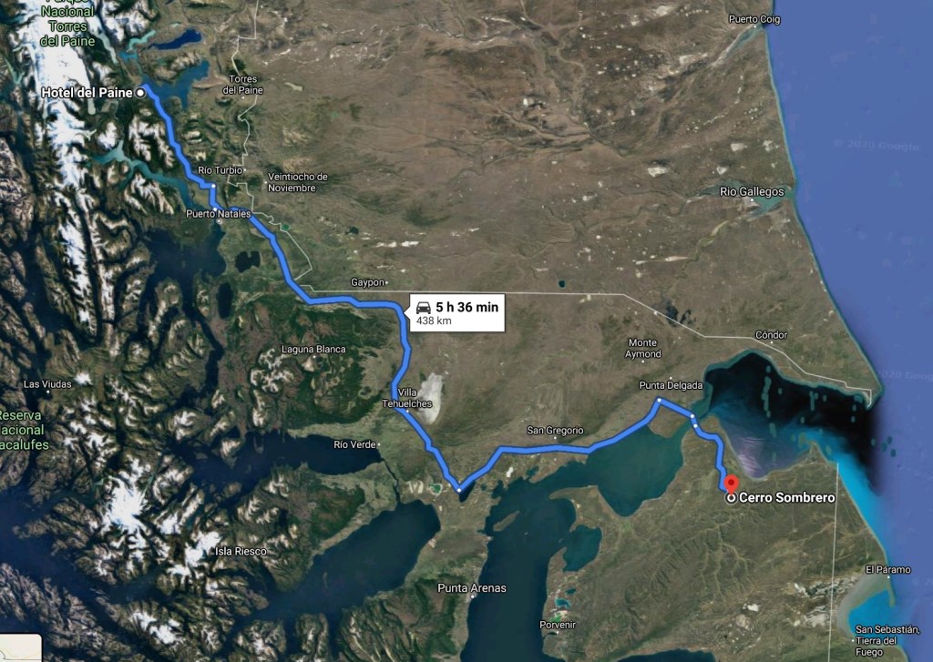
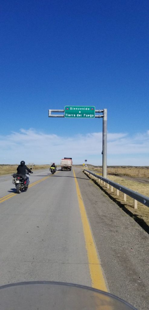
We then headed back to the open plains of Chile and south onto the island of Tierra del Fuego by crossing the Strait of Magellan by ferry. Below is a good map of the area which shows the Strait of Magellan. The Strait is an important passage between the Pacific and Atlantic. Ferdinand Magellan’s original name for the strait was Estrecho de Todos los Santos (“Strait of All Saints”). Charles V, the financier of the Magellan exploration, changed the name to Strait of Magellan to honor him. The route is difficult to navigate due to frequent narrows and unpredictable winds and currents. The strait is shorter and more sheltered than the Drake Passage, the often stormy open sea route around Cape Horn, which is beset by frequent gale-force winds and icebergs. Along with the Beagle Channel, the strait was one of the few sea routes between the Atlantic and Pacific before the construction of the Panama Canal.
Below is a photo of the Bahia Blanco, the port on the Strait that we disembarked upon when entering Tierra del Fuego…not much to see but an important departure point to the southernmost landmass in the world. You can see in the map above that Tierra del Fuego is bordered on the west by the Strait, the south by the Beagle Channel and the East by the Atlantic.

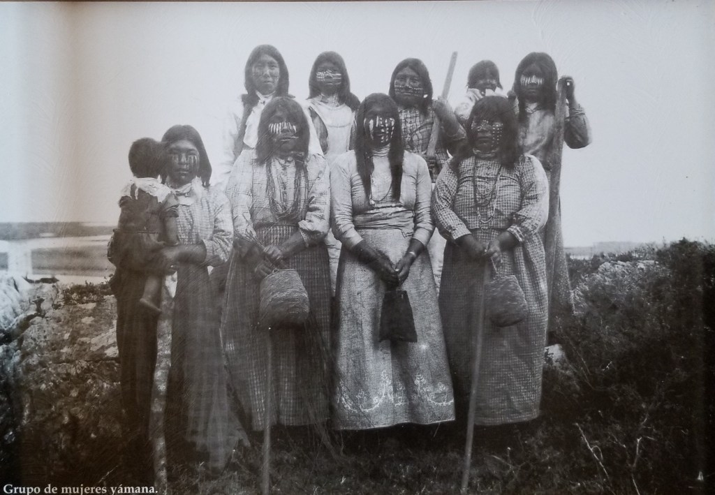
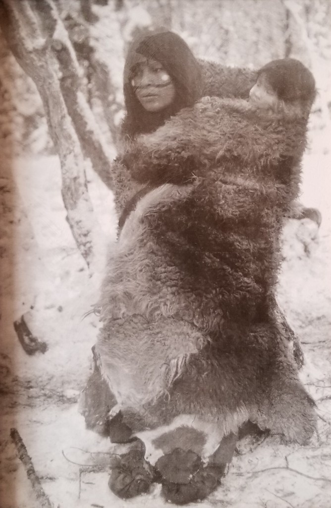
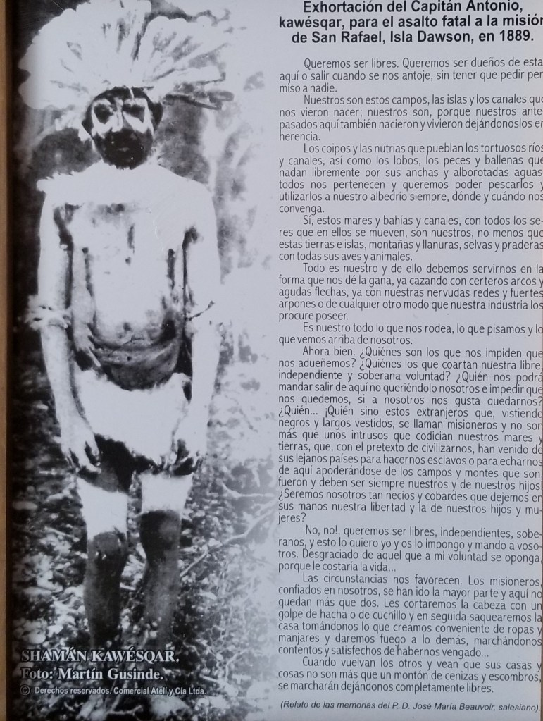
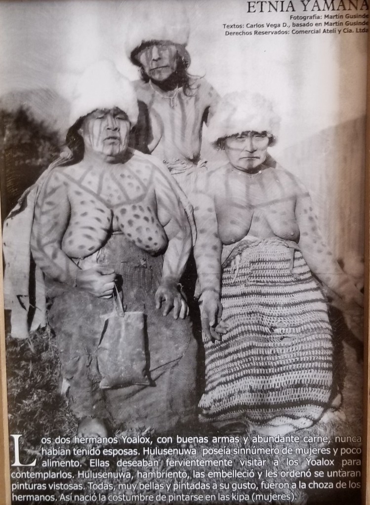
Cerro Sombrero is one of the end of the road type towns, which I love to explore. Our hotel is below and is a place that is typically populated by oil and gas workers. It’s very basic, but in the entryway were a series of photos from many years ago of the native Indians that were the original inhabitants of Tierra del Fuego. I’ve reproduced them for you here. I found them fascinating.


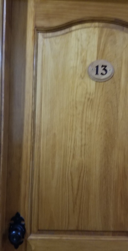
As luck would have it, I was assigned room 13 on Friday the 13th. I was hoping this was not an indication that my luck on this trip (which has been extensive) had run out.
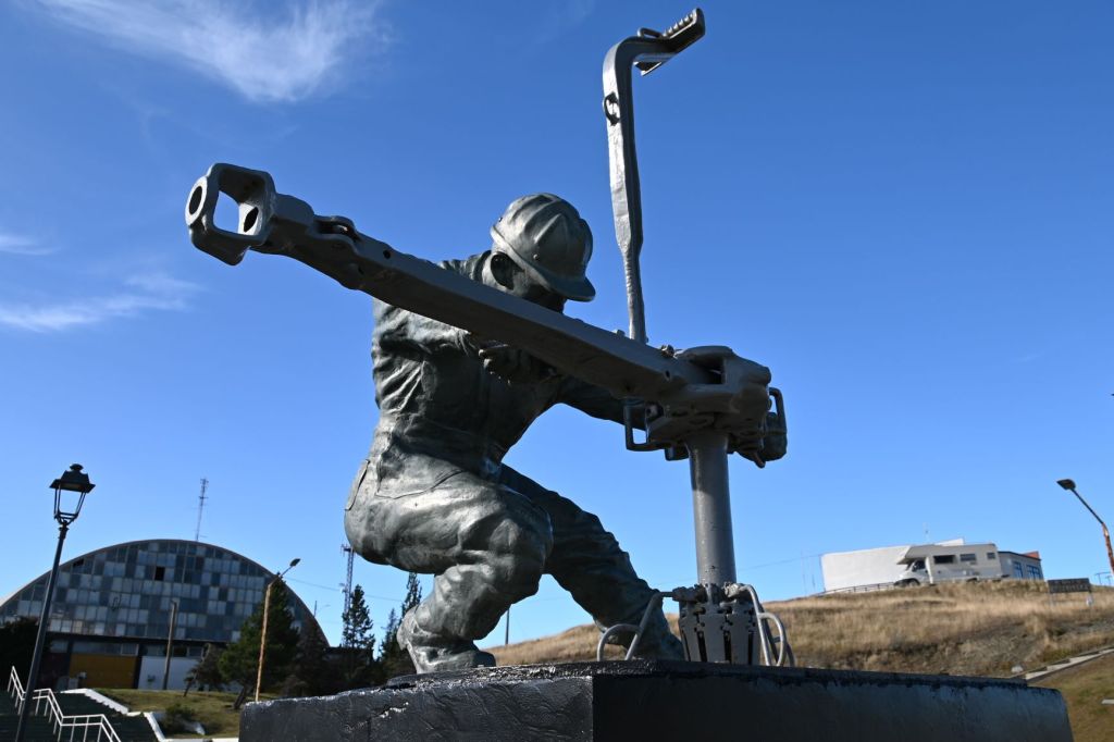
I took a couple hours and walked around the small village. Below are some pics that attempt to capture it…a wind-blown frontier town with not much going on. However, the sculpture in the town square, reminded me of the Soviet style of sculpture we saw a lot of on the Mongol Rally.


March 14 – Cerro Sombrero, Chile to Ushuaia, Argentina

This leg of the journey was a surprise to most of us. I had expected that the terrain would be flatish and not that interesting, but it turned out to be very different that this. Ushuaia and the area surrounding it is the only part of Argentina that is located on the western side of the Andes, so to get to Ushuaia we had to go back up and over the Andes. The Andes decline in height from North to South, so the mountains were more in the 2,000 meter zone in contrast to the north, where they are as high as almost 7,000 meters.
The story of how the border came into being here is an interesting one. In the 1980’s the boarder in this area, as well as much of Patagonia, was still in dispute. The countries of Argentina and Chile were attempting to negotiate a peaceful settlement of the boarder and they ran into issues that were not reconcilable by the teams. As a result, the two very Catholic countries turned to the Vatican to mediate the dispute and Pope John Paul II defined the boarders between the two countries leading to a triangular piece of Argentina being isolated from the rest of the country and only accessible by crossing the Strait.
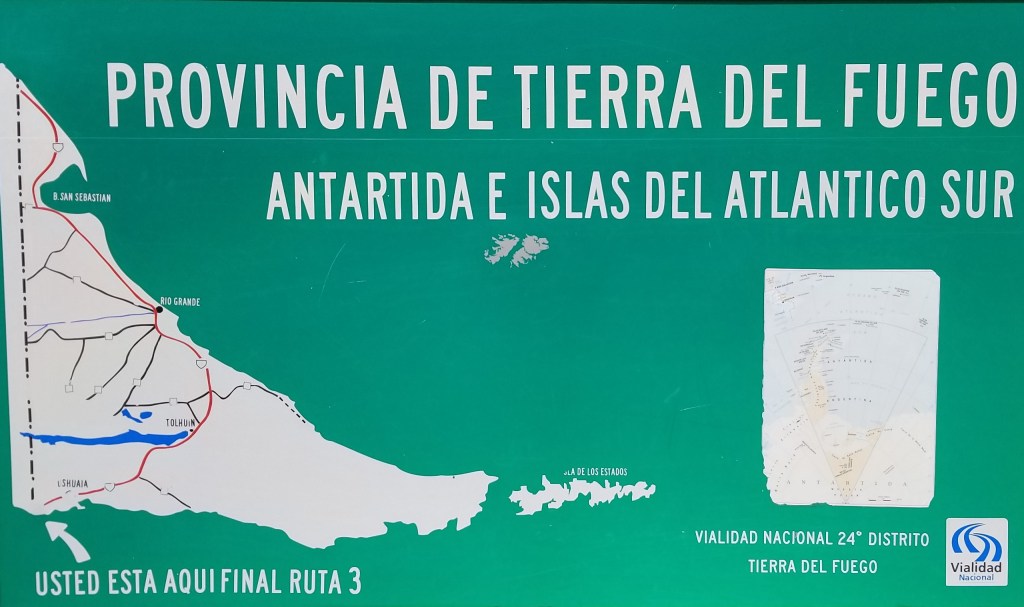
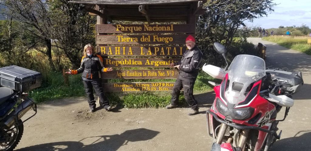
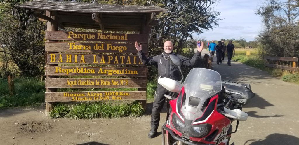
Ushuaia is also considered to be the Fin del Mundo and southernmost part of the world that can be reached via a road. There is a famous sign here that travelers go to and capture a picture documenting reaching the journey’s end.
Of course, we did the same.
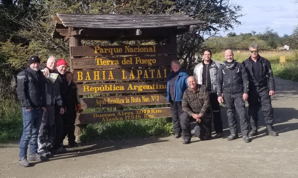
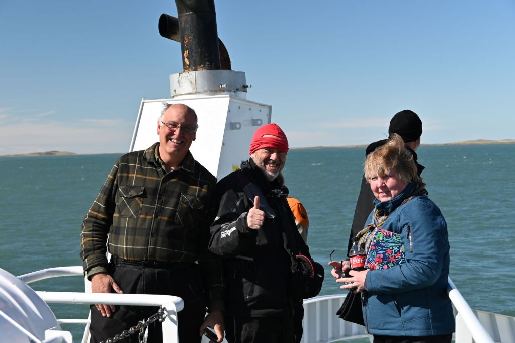
Above is the group whom I’ve greatly enjoyed riding from Pucon to Ushuaia: Phil, Mike, Gary, Illiana, Jane, Kevin, Craig and JD. Missing are Eric, John and Randy.
I’ll provide another couple posts as a wrap on the trip in the next couple days.
Hasta luego amigos!!!
